 The SO-WATCH framework will be developed and demonstrated on the Lake Como river basin, Italy.
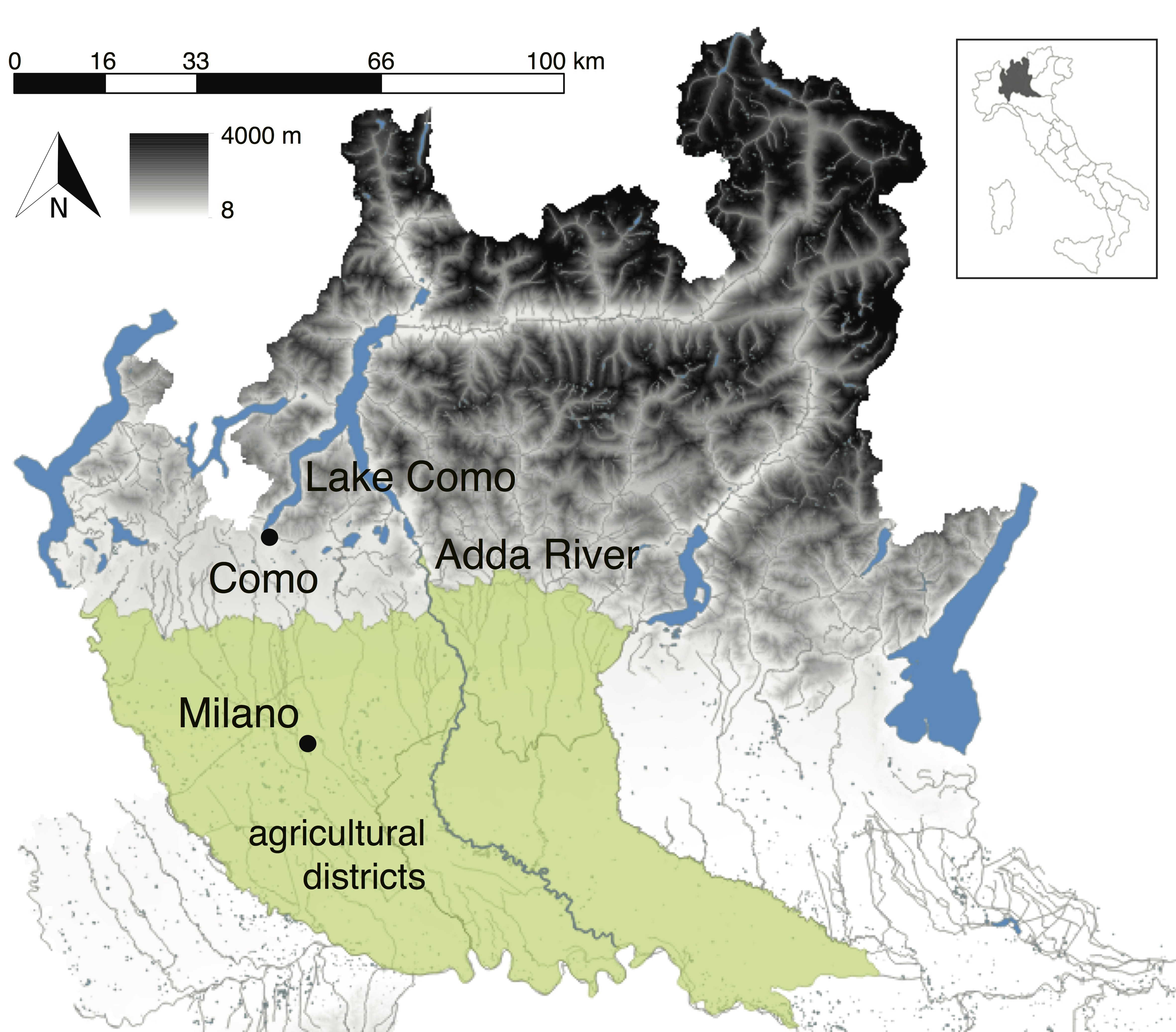
Located in the Italian Southern Alps, the Lake Como basin is a heavily man-overworked water system, including one large regulated lake (active capacity 247 Mm3), many hydropower reservoirs (overall capacity 545 Mm3), and a large irrigation-fed cultivated area (1,320 km2), where maize is the most widely grown and productive crop (52% of the area and 1.5 Mton/year). Besides, flood protection on both the lake shores (particularly in the town of Como) and along the river, recreation and environmental protection are other primary objectives in the basin management.
Snowmelt from May to July is the most important contribution to the creation of the seasonal storage, which is reallocated over the year with two different strategies according to the two primary objectives of watershed management (i.e. crop and energy production). Hydropower reservoirs exploit the accumulated volume in the following fall and winter, when the production is more valuable. The lake goes through the first drawdown cycle in the summer to provide adequate supply to agriculture for the peak demand period. This results in the potential conflict between farmers and hydropower companies, which recently exploded during the extremely dry summer of 2003 and 2005. Moreover, similar situations are likely increasing in the next years because of climate change, which is expected to impact significantly the variability of precipitation and temperatures in the Alpine environment, with potentially intensive fallout on stream flow regime and seasonal snow cover availability. In addition to its intrinsic relevance and the key challenges it poses, the Lake Como water system was selected for SO-WATCH because it might be considered as a paradigmatic example of many Alpine watersheds: large storage capacity distributed in small reservoirs, mainly operated for hydro-power production and located in the upper watershed region; significant contribution of the snow-dynamics to the hydrological cycle; regulated lakes in the middle region; and multiple, often conflicting water consumption users, mainly wide agricultural areas, in the lower region.